Finding affordable insurance isn’t just about checking a flood map; it’s about uncovering the hidden geological and man-made risks that standard insurers are programmed to avoid.
- Standard policies use broad ‘ground movement’ exclusions to avoid claims from subsidence, coastal erosion, and even fracking-related tremors.
- Government-backed schemes like Flood Re and the Mining Remediation Authority offer crucial safety nets, but they have specific limits and aren’t a permanent solution.
Recommendation: The most effective strategy is to adopt a ‘Data Trinity’ approach—cross-referencing Public, Purchased, and Survey data—to build a complete risk profile *before* you exchange contracts.
You’ve found it. The dream home. It has the right character, it’s in the perfect location, and the price is manageable. You put in the offer, it’s accepted, and you start the mortgage and conveyancing process. Then comes the gut-wrenching email: « Unfortunately, we are unable to offer insurance for this property. » It’s a moment of pure frustration. You did your homework; you checked the Environment Agency’s public flood map, and it all seemed fine. So why has the computer said no?
As a specialist insurance broker, I see this scenario play out constantly. Homebuyers are often blindsided because they believe that a clear flood map equals an insurable property. This is a dangerous oversimplification. Insurers operate on a deeper level, assessing a complex web of « underwriting blindspots »—hidden risks that don’t appear on a simple map. These can range from a property’s proximity to an unassuming canal culvert to the legacy of coal mines closed a century ago. Standard insurance policies are filled with carefully worded exclusions for ‘ground movement’ or ‘coastal erosion’ that a standard buyer would never notice until it’s too late.
The key to navigating this landscape is to stop thinking like a homebuyer and start thinking like an underwriter. While schemes like Flood Re are an essential safety net for many, they are just one piece of a much larger puzzle. The real power lies in understanding the *why* behind an insurer’s refusal. It’s about learning to identify the subtle clues in a property’s history and location that signal high risk.
This guide is designed to give you that power. We will move beyond the basic checks and delve into the specialist risks that can render a property uninsurable. We will explore how to interpret geological data, understand the limits of standard policies, and ultimately, how to build a comprehensive risk profile that protects you from a disastrous purchase. By the end, you’ll know how to spot the red flags before your insurer does.
This article will guide you through the complex world of property risk assessments. We’ll break down the key issues that affect insurability, providing the insights you need to make an informed decision. The following table of contents outlines the journey ahead.
Summary: A Homebuyer’s Guide to Navigating Uninsurable Property Risks
- Buying a House with a History of Movement: Is It Insurable?
- Coastal Erosion Risk: Why Standard Policies Exclude the Sea Taking Your Garden?
- Fracking Induced Earthquakes: Are They Covered Under Standard ‘Ground Movement’?
- Living Near a Canal or Culvert: The Hidden Flood Risk Not on the Main Map?
- Why Buying in Flood Zone 3 Can Double Your Premium Despite Defences?
- Environment Agency Maps: How to Check if Your Dream Home Is uninsurable?
- Coal Mining Reports: Do You Need Special Insurance in a Former Mining Area?
- The Homebuyer’s Risk Report: How to Spot Uninsurable Issues Before You Buy?
Buying a House with a History of Movement: Is It Insurable?
Few words strike more fear into a homebuyer’s heart than ‘subsidence’. It’s a common exclusion and a major red flag for insurers, primarily because the costs are so high. The average claim payout for subsidence can be significant; for instance, recent data showed payouts averaging around £17,264, reflecting the complexity of underpinning and repairs. Insurers see a property with a history of movement not just as a past claim, but as a future liability. They will want to see a Certificate of Structural Adequacy and full details of the repairs, including any guarantees, before even considering cover.
The challenge is distinguishing between benign settlement (common in new builds) and genuine subsidence, heave, or landslip. Subsidence is the downward movement of the ground beneath a building, often caused by tree roots drawing moisture from clay soil, especially during dry spells. Heave is the opposite, an upward movement. A surveyor will look for key warning signs:
- Look for cracks more than 3mm wide (roughly the depth of a £1 coin) that are diagonal and wider at the top than the bottom.
- Check if the same cracks are visible both inside and outside the property.
- Identify if doors and windows are sticking without an obvious cause like damp or recent painting.
- Examine wallpaper for ripping or crinkling in areas not affected by damp.
- Note that subsidence cracks usually appear very suddenly, rather than gradually—if in doubt, seek professional advice and speak to your insurer.
Even if the property has been professionally underpinned, securing insurance can be difficult. Many mainstream insurers will decline to quote, forcing you into the specialist market where premiums are higher and policy excesses for subsidence can be £5,000 or more. A history of movement permanently marks a property’s record, making full disclosure and expert brokerage essential.
Coastal Erosion Risk: Why Standard Policies Exclude the Sea Taking Your Garden?
For many, a home with a sea view is the ultimate dream. But for insurers, it can be a recurring nightmare. Standard home insurance policies are designed to cover sudden and unforeseen events, not gradual, inevitable processes. Coastal erosion falls firmly into the latter category. Your policy might cover storm damage to your roof, but it will almost certainly contain a specific exclusion for damage caused by erosion, subsidence, or landslip relating to the action of the sea.
This creates a terrifying « liability cascade » for homeowners. If a portion of your garden, or worse, your house, falls onto a beach or a neighbour’s property, you may not only be uninsured for your own loss but could also be held liable for the damage caused below. This isn’t a theoretical problem. Consider the real-life case of a homeowner in Eastbourne who was horrified when part of their cliff-top garden collapsed onto beach huts below. As their home insurance didn’t cover coastal erosion, they were deemed personally liable for the substantial damage to the promenade and huts.
The scale of this issue is growing. While data from climate analysis shows around 4,000 properties in the UK are currently at substantial risk, this number is projected to rise dramatically. Insurers and mortgage lenders are increasingly using detailed coastal erosion maps to red-line entire postcodes, making it impossible to get a mortgage or insurance. If you’re buying near the coast, your due diligence must go beyond a standard survey; you need a specialist report that considers long-term erosion projections.
Fracking Induced Earthquakes: Are They Covered Under Standard ‘Ground Movement’?
The debate around hydraulic fracturing, or « fracking, » often focuses on its environmental impact, but for homeowners in potential exploration areas, it raises a crucial insurance question. What happens if one of the resulting earth tremors damages your property? The answer is buried in the ambiguity of your policy wording. Most home insurance policies cover damage from seismic activity, but they are often written with natural earthquakes in mind, not man-made ones.
The link between the activity and tremors is not in doubt. As the British Geological Survey (BGS) confirms, it’s a known phenomenon. In a guide published by Friends of the Earth UK, the BGS is cited:
According to the British Geological Survey, it is well known that hydrocarbon exploration and production can result in man-made or ‘induced’ earthquakes.
– British Geological Survey (BGS), Friends of the Earth UK – Fracking earthquakes guide
This creates an underwriting blindspot. An insurer could argue that damage from a fracking-induced tremor is not a natural peril but a result of industrial activity. They might point to the general ‘ground movement’ or ‘subsidence’ exclusions, or even a pollution exclusion, to deny a claim. The homeowner would then be left in a legal limbo, trying to prove causation and navigate a claims process against a well-resourced exploration company. This is not a situation any homeowner wants to be in.
While the UK currently has a moratorium on fracking, the legislative and geological landscape could change. For buyers in areas with a history of oil and gas exploration, this remains a pertinent, if dormant, risk. It highlights the importance of understanding not just what your policy covers, but what it implicitly excludes through broad, catch-all terminology. An environmental search during the conveyancing process should identify if the property is within a licensed exploration block, a critical piece of information for assessing long-term risk.
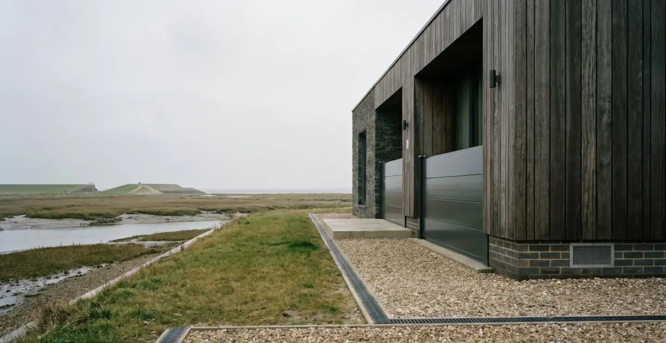
Living Near a Canal or Culvert: The Hidden Flood Risk Not on the Main Map?
You’ve checked the Environment Agency flood map, and your property is in Flood Zone 1 – the lowest risk. You breathe a sigh of relief. However, at the bottom of your garden, there’s a small, unassuming stream that disappears into a brick-lined tunnel, or a major canal runs a few hundred metres away. These features, known as culverts and canals, represent a significant and often unmapped flood risk that standard data sources can miss. This is a classic « underwriting blindspot. »
A culvert is a pipe or tunnel that channels a watercourse under a road, railway, or development. If the grille at its entrance becomes blocked with debris—a common occurrence during a heavy downpour—the water backs up rapidly, flooding an area that the maps say is safe. Similarly, canal banks can fail, or overflow mechanisms can be overwhelmed, leading to sudden inundation. Responsibility for maintenance is often complex; homeowners who have such watercourses on or adjacent to their land may be deemed ‘riparian owners’ with legal duties of care.
If you’re buying a property near any man-made watercourse, you must conduct your own due diligence. Don’t rely solely on the main flood maps. A proactive approach is essential to protect your investment and ensure you have the right insurance cover in place, as a standard flood peril might not respond in the same way as a ‘Full Accidental Damage’ clause for a sudden culvert collapse.
Your Five-Step Canal and Culvert Risk Audit
- Identify Ownership: Determine if you are a riparian owner responsible for any watercourses (culverts, ditches, streams) that run through, beneath, or adjacent to your land.
- Check Maintenance Schedules: Contact the Canal & River Trust or your local water company to check maintenance schedules for infrastructure near your property.
- Document and Report: Photograph any blocked culvert grilles or failing canal banks and immediately report them to the responsible authority (e.g., Canal & River Trust: 0303 040 4040).
- Verify Your Cover: Ask your insurer to confirm in writing if ‘Full Accidental Damage’ is included, as this is more likely to cover a sudden culvert collapse than a standard flood clause.
- Create a Paper Trail: Meticulously document all communications with authorities. This evidence can be invaluable in a future insurance claim if flooding occurs due to neglected maintenance.
Why Buying in Flood Zone 3 Can Double Your Premium Despite Defences?
Buying a house in Flood Zone 3, the highest-risk category, seems counterintuitive. Yet, many properties in these zones are protected by extensive, multi-million-pound flood defence schemes. As a buyer, you might assume these defences make the property safe and cheap to insure. This is a common and costly mistake. Insurers price based on « residual risk »—the risk that remains *after* defences are in place.
While a major flood wall might protect against a 1-in-100-year event, the insurer is still concerned about the 1-in-200-year event that could overtop it, or a catastrophic failure of the defence itself. This is why your premium can still be double or triple that of a similar property in a low-risk zone. To manage this, the government and insurance industry created Flood Re. This is a reinsurance scheme that effectively subsidises the flood risk element of home insurance for high-risk properties. It caps the flood portion of your premium at a level based on your council tax band, making insurance affordable for hundreds of thousands. Indeed, industry estimates show around 350,000 properties are expected to benefit.
However, Flood Re is not a silver bullet, nor is it permanent. It doesn’t cover properties built after 2009, most leasehold properties, or commercial premises. Crucially, it has an end date. As Flood Re themselves state, the scheme is designed to operate as a bridge to a risk-reflective market. According to their official information, « Flood Re is planned to be in place until 2039 and after this date, there will be a free market for flood risk insurance. » This means that while cover may be affordable now, there is no guarantee it will remain so in the long term, a fact that should be a major consideration in your purchase decision, especially with projections indicating that by around 2050, 8 million properties (one in four) could be at risk.
Environment Agency Maps: How to Check if Your Dream Home Is uninsurable?
The first port of call for any diligent homebuyer is the Environment Agency’s (EA) long-term flood risk map. It’s free, easy to use, and provides an excellent overview of the primary flood risks from rivers and the sea. However, treating this map as the definitive and final word on a property’s flood risk is a serious error. It is a starting point, not a conclusion. A property can appear to be in a low-risk zone on this map yet be uninsurable due to other factors the map doesn’t show.
The EA’s own service provides multiple data layers, and a comprehensive assessment requires looking at all of them. You need to check for fluvial (river), pluvial (surface water), and even reservoir breach risks. A property might be safe from the nearby river but sit in a dip that is at high risk of surface water flooding during a torrential downpour. Furthermore, the EA maps are not exhaustive; they do not include thousands of smaller watercourses or the hidden risks from culverts we discussed earlier.
To truly understand the data, you must use it as an investigative tool, not a simple pass/fail test. A sophisticated buyer or their solicitor should follow a multi-step process to build a more accurate picture, cross-referencing the digital data with physical observations.
- Access the Environment Agency’s ‘check the long term flood risk for an area in England’ tool and enter the property postcode.
- Overlay Map Layer 1—’Rivers and Sea’ flood risk to identify fluvial and coastal flood zones (check if property is in Flood Zone 2 or 3).
- Overlay Map Layer 2—’Risk of Flooding from Surface Water’ to identify pluvial flood risk not captured in main river models.
- Overlay Map Layer 3—’Reservoirs’ to check if the property would be affected in a worst-case reservoir failure scenario.
- Cross-reference findings with Ordnance Survey maps to identify unmapped small watercourses and plan a physical site visit to assess hidden risks on the ground.
This layered approach moves you from a passive consumer of data to an active investigator of risk, a crucial mindset shift when making one of the biggest financial decisions of your life.
Coal Mining Reports: Do You Need Special Insurance in a Former Mining Area?
Vast swathes of the UK are built on former coalfields. While the mines may have closed decades ago, the legacy of tunnels and shafts beneath the ground presents a unique risk of subsidence. If you are buying in a designated coal mining area, your solicitor will commission a CON29M report. This report will reveal if the property is in an area susceptible to mining-related ground movement. If it is, a common misconception is that you need a special, expensive type of home insurance.
The reality is more nuanced and involves a critical distinction between statutory cover and commercial cover. Damage from coal mining subsidence is not typically claimed through your home insurance policy. Instead, there is a specific statutory scheme managed by the government-run Mining Remediation Authority (formerly the Coal Authority). This body is legally obligated to repair damage caused by historic coal mining and, in some cases, pay compensation. Your home insurance policy is the secondary, not primary, route for a claim.
The process is therefore quite different from a standard subsidence claim:
- You must download and complete the Mining Remediation Authority’s Damage Notice Form.
- You should still notify your home insurance provider, but make it clear the claim is being pursued through the statutory authority.
- The Authority will assess the claim and, if liable, will manage and pay for the repairs.
- After repairs are complete, it is vital to obtain all documentation, including completion certificates and transferable guarantees.
- You must present this documentation to future insurers. Securing cover after a mining subsidence claim can be challenging, and you should expect higher premiums and different terms, even though the primary risk is covered elsewhere. This is because the event still flags the property as high-risk for other types of ground movement.
With analysis of British Geological Survey data revealing a potential 27% rise in homes at risk of subsidence by 2050, understanding every facet of ground movement is more critical than ever.
Key Takeaways
- Standard insurance policies are designed with specific exclusions for ‘ground movement’ which can catch inexperienced buyers out.
- Official data, like Environment Agency flood maps, is only the starting point; hidden risks like blocked culverts or historic mining require deeper investigation.
- A ‘Data Trinity’ approach—combining public, purchased, and survey data—is the most effective way to uncover a property’s true risk profile.
The Homebuyer’s Risk Report: How to Spot Uninsurable Issues Before You Buy?
We’ve journeyed through a landscape of hidden risks, from the slow creep of coastal erosion to the sudden collapse of a canal bank. The unifying theme is that a single source of data is never enough. To truly assess a property’s insurability and protect your investment, you must adopt a professional-grade due diligence framework. In my experience as a broker, the most effective approach is what I call the « Risk Data Trinity »: combining Public, Purchased, and Survey data to build a complete, three-dimensional picture.
This framework forces you to cross-reference information, spotting discrepancies and red flags that would otherwise be missed. For instance, the free Public data from the EA might show low flood risk, but a Purchased environmental report could flag the land as ‘Infilled’, a major subsidence risk. Then, the RICS Level 3 Survey data might identify specific structural cracks that correlate with that infill risk, turning a vague warning into a tangible, and negotiable, problem.
An environmental search report can be dense, but learning to spot key « red flag » terms is crucial. These terms are the language insurers use to decline risk, and understanding their implications can save you from a financial catastrophe. This table breaks down some of the most common red flags and what they mean for your insurance prospects.
As this comparative analysis demonstrates, each term carries significant weight for underwriters.
| Red Flag Term in Report | What It Means | Insurance Implication |
|---|---|---|
| Contaminated Land Entry | Property on or near land previously used for industrial purposes or waste disposal | May require specialist environmental liability insurance; standard home insurance may exclude pollution-related claims |
| Infilled Land | Ground made up with materials of unknown origin or stability | Higher subsidence and settlement risk; expect elevated premiums and potentially higher excess (£5,000-£25,000) |
| Radon Affected Area | Property in area where radon gas (naturally occurring radioactive gas) is prevalent | Usually insurable but may require radon mitigation system installation; does not typically affect premium |
| High Shrink-Swell Clay | Soil type that expands when wet and contracts when dry (common in South-East England) | Elevated subsidence risk; higher premiums and mandatory subsidence excess clauses apply |
| Historic Coal Mining Activity (CON29M) | Property in area of past coal extraction with potential for ground movement | Claims handled by Mining Remediation Authority not home insurer; must disclose on future policies |
Using these identified risks, such as a high subsidence risk that requires a £5,000 excess, can become powerful leverage to negotiate a price reduction or insist on seller remediation before you complete the purchase.
Armed with this knowledge, you are no longer a passive buyer but an informed investor. The next logical step is to commission a comprehensive environmental report and discuss its findings with a specialist insurance broker to secure the right protection for your new home.